
EISCAT_3D is a next-generation geospace research radar infrastructure. Designed to advance our understanding of the Earth’s atmosphere and its interaction with near-Earth space.

The EISCAT_3D radar system is still under development and is not yet operational.
By combining cutting-edge radar technology with this exceptional location, EISCAT_3D provides unprecedented opportunities to study how solar activity influences the upper atmosphere, satellites and technological systems on Earth. With its location in the Northern Fenno-Scandinavia in the Arctic, the system takes advantage of a uniquely favourable geographical position, beneath the auroral zone, where space weather effects are strongest and most dynamic. The knowledge gained is essential for improving space weather forecasting, safeguarding critical infrastructure such as satellite navigation and communications, and supporting long-term climate and atmospheric research.
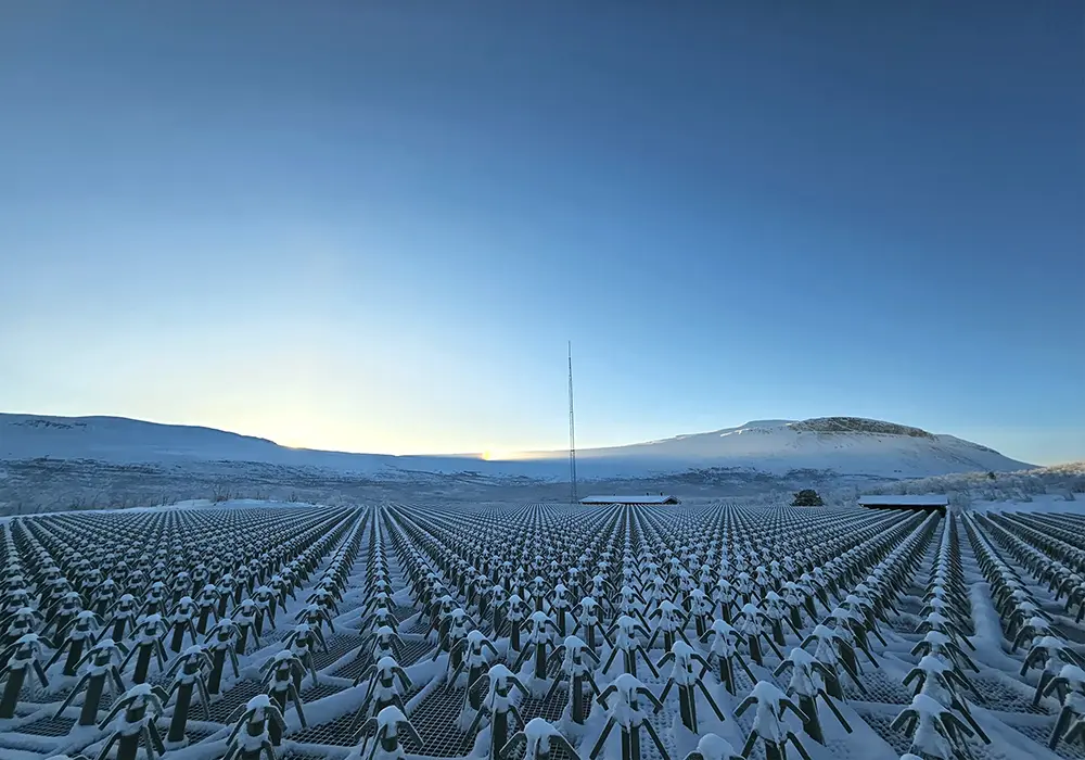
EISCAT_3D antenna plane with the small dipole antennas.
Photo: Johan Svensson
A unique radar system for a changing society
EISCAT_3D is the most advanced high-power three-dimensional imaging radar ever built for atmospheric, ionospheric and near-Earth space investigations. It is a tri-static, phased-array incoherent scatter radar, consisting of three sites located in Skibotn (Norway), Karesuvanto (Finland) and Kaiseniemi (Sweden).
The core site, with transmit–receive capabilities, is the array in Skibotn. Comprised of around 10,000 antenna elements, complemented by additional outrigger receivers for calibration. The two receiver sites in Finland and Sweden each host approximately 5,000 receive-only antenna elements. Together, the sites form a large, distributed radar system. A system capable of observing vast atmospheric volumes in three dimensions, with high spatial and temporal resolution.
Unlike traditional radar systems that observe only a single direction at a time, EISCAT_3D can form multiple radar beams simultaneously and steer them electronically within milliseconds. This feature allows researchers to capture fast-changing geophysical processes in their full spatial context and to distinguish between variations in time and space.
Scientific excellence with broad impact
The EISCAT_3D system is primarily designed to study the ionosphere, the electrically conducting region of the atmosphere above about 80 km altitude. But it also enables observations of the middle atmosphere, meteors and space debris. When the transmitters are inactive, the system can be used for radio astronomy observations.
The radar supports a wide range of scientific and societal applications, including:
- improved space weather monitoring and forecasting,
- enhanced understanding of solar–terrestrial coupling,
- detection and tracking of space debris and satellites,
- long-term studies of atmospheric dynamics and climate-related processes.
These capabilities are increasingly important in a society that relies heavily on space-based technologies and is vulnerable to disturbances caused by solar activity.
An international infrastructure with a proven heritage
EISCAT_3D is operated by EISCAT AB and the company has more than 40 years of experience in operating incoherent scatter radars. EISCAT inaugurated its first radar system was in 1981 and the second one in 1996. This long-standing expertise ensures reliable operations, high-quality data products and strong international collaboration.
The planning for EISCAT_3D began in the early 2000s. A long process of design- and feasibility studies followed. The construction phase began following the project kick-off in September 2017. At present time, all the antenna units have been installed at all three sites. Along with internal power and fibre infrastructure. Installation of control and monitoring systems is underway, and much of the custom-built radar electronics has already been manufactured.
A scalable system for the future
EISCAT_3D is designed to be a modular and expandable system. Its implementation is planned in stages:
- Stage 1: Three operational sites
- Stage 2: Transmitter upgrade to 10 MW
- Stage 3: Addition of a fourth site
- Stage 4: Addition of a fifth site
When EISCAT_3D is fully implemented, it will form the backbone of an international network for monitoring the Earth’s upper atmosphere and near-Earth space. Its combination of advanced technology, Arctic location and operational flexibility places Europe and the Nordics at the forefront of global geospace research and provides long-term benefits for science, innovation and societal resilience.