
In northern Norway, Svalbard, Sweden and Finland, large antenna fields rise like futuristic works of art. They belong to EISCAT.
The radar system that reveals the secrets of geospace and the atmosphere
EISCAT is an international research radar provider, that has been studying the interaction between the sun, space and Earth for over 40 years. By sending radio waves into the sky and analysing the faint echoes that bounce back, researchers gain unique insights into the ionosphere, the charged layer of the atmosphere that affects spacecraft, navigation systems and our climate.
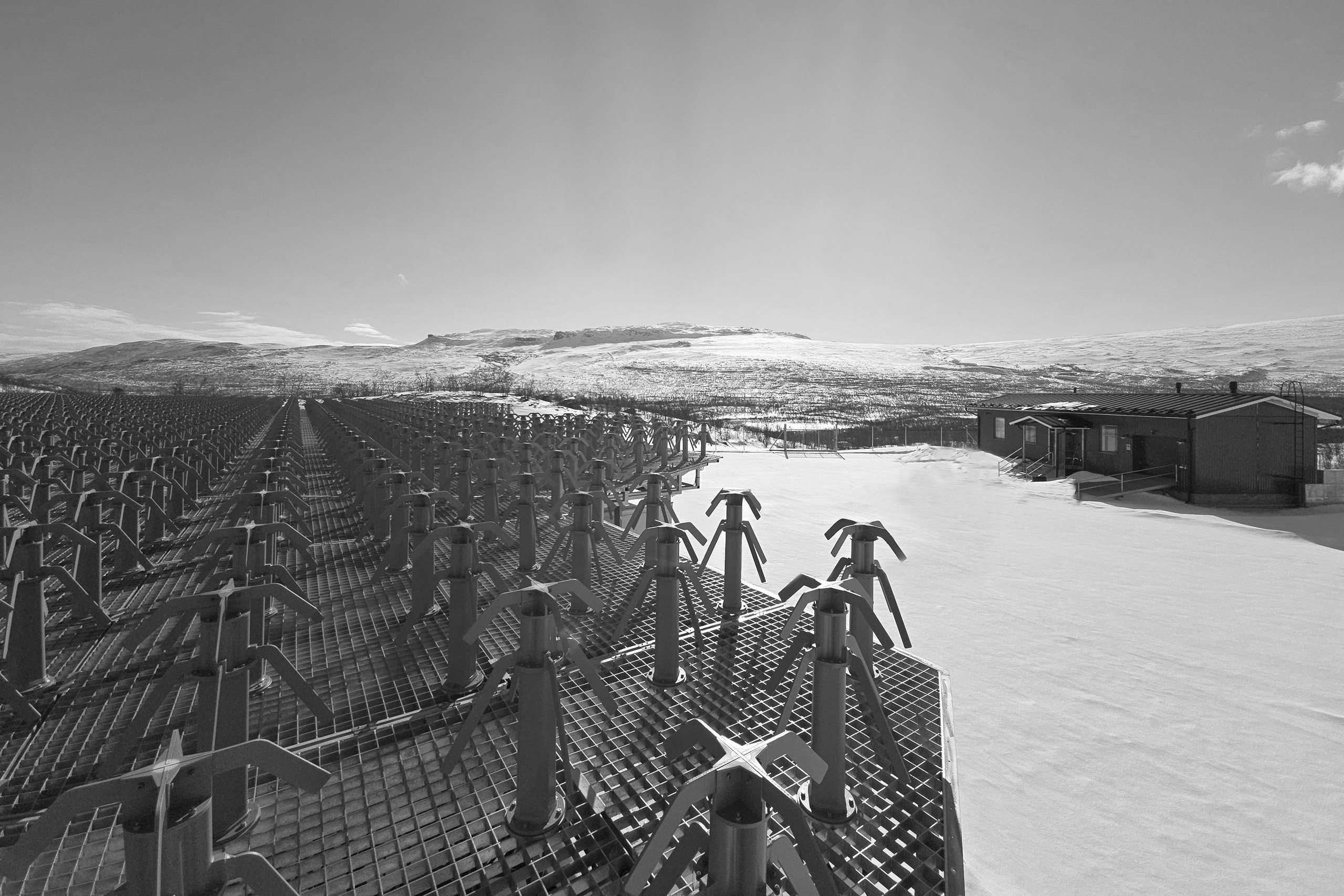
The edge of the antenna plane of EISCAT_3D Kaiseniemi.
Photo: Johan Svensson
Deeper understanding of the interaction between the sun and Earth
The sun is a dynamic star that occasionally ejects enormous amounts of charged particles into space. When these particles reach Earth, they can disrupt our magnetic field, create spectacular auroras and cause technical problems. EISCAT measures how these events affect the ionosphere in real time. This knowledge is invaluable for:
Space weather and solar activity: EISCAT can track how solar storms and coronal mass ejections affect Earth’s magnetic field and atmosphere. This helps us understand the dynamics of the Sun-Earth system and is crucial for astrophysics and space research.
Atmospheric physics: By studying the ionosphere, researchers gain insights into how energy and particles are transported between space and Earth, which in turn increases our understanding of long-term climate development.
Space plasma physics: The measurements reveal details about plasma flows, waves and turbulence in the space environment, which is central to theories about the interaction between the magnetosphere and the solar wind.
From measurement data to societal benefits
EISCAT’s advanced radars not only provide basic researchers with new insights, but is also used for practical applications that benefit us all in our everyday lives:
Improved satellite navigation and GPS accuracy: By monitoring the state of the ionosphere, EISCAT data can be used to reduce disturbances that could otherwise lead to errors in navigation systems and satellite communications. Ionospheric disturbances can cause your GPS to show errors of several metres. By monitoring and modelling these disturbances, EISCAT data can contribute to corrections that make navigation systems more reliable – important for everything from air traffic control to self-driving vehicles.
Communication: Radio communication and satellite links can be affected by space weather. EISCAT helps predict and mitigate these effects, which is crucial for global internet, military security and emergency systems.
Space debris monitoring: EISCAT_3D, the new generation of radar, can detect small metal fragments that are otherwise invisible to many monitoring systems. This capability protects satellites and reduces the risk of collisions in orbit.
Space weather forecasts: Just as meteorologists need weather data on Earth, spacecraft and energy companies need information about space weather to prevent disruptions to power grids and communication systems. Powerful solar storms can induce currents in power grids, which can cause major power outages. By understanding these processes, power companies and authorities can prevent damage.
Technology that creates new opportunities
The cutting-edge technology developed for EISCAT – in radar, signal processing and data collection – often finds new areas of application:
Telecommunications: Improved antenna technologies and algorithms first developed for space research can improve mobile networks and broadband solutions.
Medicine and industry: Advanced signal analysis can be applied in medical imaging diagnostics or to examine materials without destroying them.
Environmental research: The same methods used to measure the ionosphere can be adapted to monitor particles and gases in lower atmospheric layers.
An international collaboration with global significance and a focus on the future
EISCAT is run by three countries: Sweden, Norway and Finland. In addition to our owner countries, we have member countries, organisations and institutes that gain access to our research facilities through their membership in EISCAT.
The new EISCAT_3D project, which uses thousands of small antennas to create a three-dimensional image of the atmosphere, makes Scandinavia a global hub for space and atmospheric research. With its high resolution and faster measurements, EISCAT_3D can help us predict space weather more accurately and provide even better data to both researchers and industry.