

EISCAT 3D design
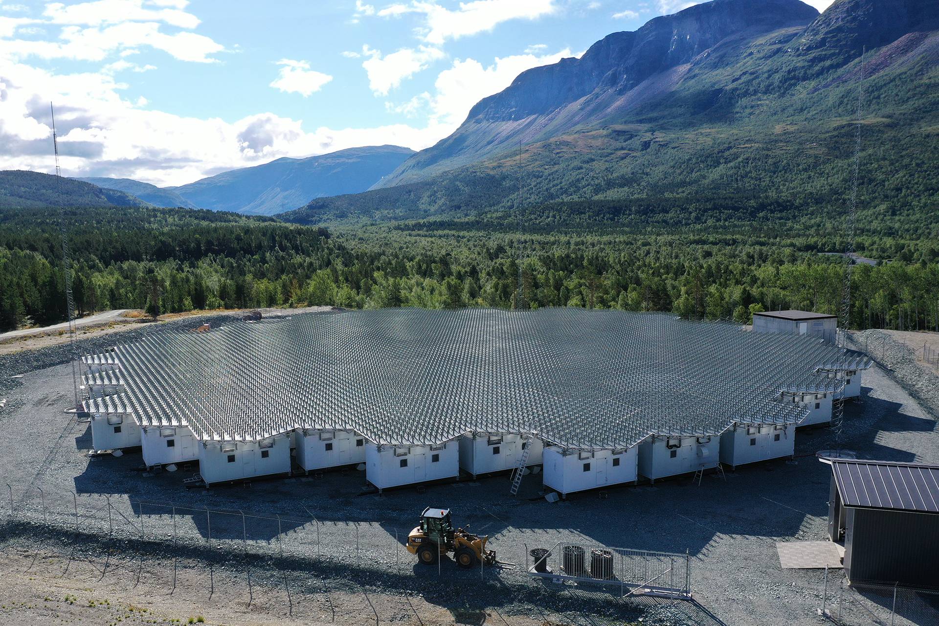
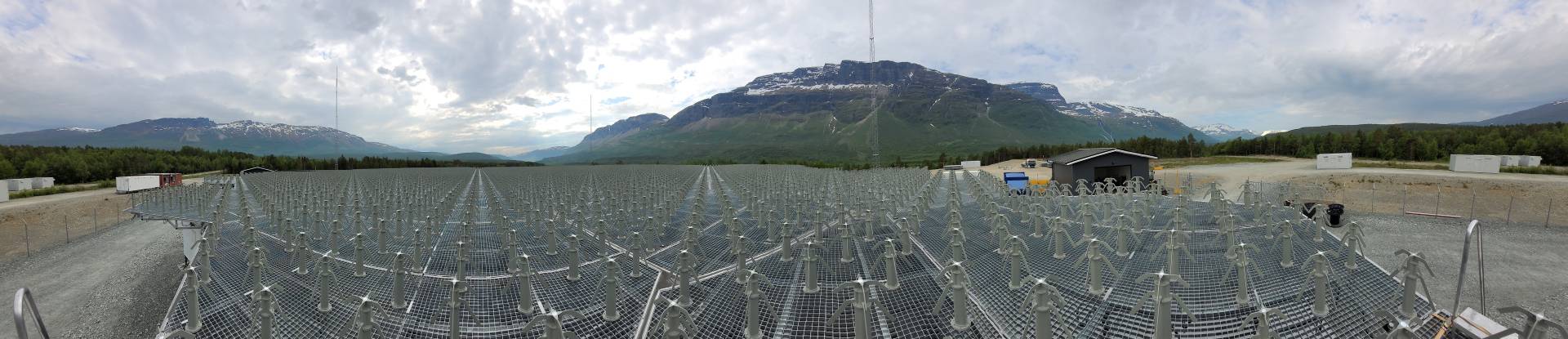
The first stage of the EISCAT 3D system is now being installed in Karesuvanto, Finland; Skibotn, Norway ans Kaiseniemi, Sweden. The first stage consist of three sites with around 20 000 crossed dipole antenna elements arranged in 228 hexagons in a honeycomb-structure.
EISCAT 3D Skibotn, Norway: 119 antenna units, 109 in the main site and 10 outriggers for calibrations. 9 919 + 910 dipole antenna elements.
EISCAT 3D Kaiseniemi, Sweden: 55 antenna units with 5 005 dipole antenna elements.
EISCAT 3D Karesuvanto, Finland: 54 antenna units with 4 914 dipole antenna elements.

One of these sites (the core site) will transmit radio waves at 233 MHz, and the other sites will have sensitive receivers to measure the returned radio signals. The array of each site will be of a size of about 70 m from side to side, and the sites will be located from 90 km to 250 km from the core site in order to be able to maximise the coverage by the system.
Hardware and software
The major hardware system blocks of the EISCAT 3D system were publicly tendered primarily during 2018 and 2019.
Antenna structure
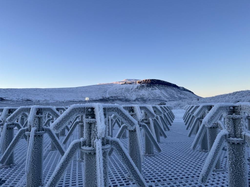
The antenna structure comes from P. R. of China and is provided by ECRIEE (East China Research Institute of Electronic Engineering). The mechanical structure is divided into 228 Antenna Units (AU). The AUs comprise of an equipment container, ground plane and 91 antenna elements.

System hardware
In each container, a receiver will be installed. The unit, the First Stage Receiver Unit (FSRU) comes from Finland and is provided by the DA-Design Group Oy. Each receiver takes the signals from all antennas of that AU and after processing, converts it to digital data streams which is then sent to the common computer cluster that will be installed in Sweden.
For transmission, some of the AUs in Skibotn will have transmitters. 182 transmitters are needed for an AU (each antenna element uses two polarisations). These transmitters are grouped into a Sub-Array Transmitter System (SAT) for each AU. The SATs comes from Finland and is provided by the DA-Design Group Oy.
For controlling the transmitters, separate Pulse and Steering Control Units (PSCU) will be needed. Each PSCU controls 16 transmitters meaning that 12 units are needed for each transmitter equipped AU. The PSCUs comes from Sweden and is provided by Qamcom Research and Technology AB.
Further system components, like network switches, timing and synchronisation units, etc, are also needed and has/will be tendered during the construction project. Other items, like the Climate and Power Control (CPC) are designed and partially built in-house. The CPC units are the intelligence inside each AU and controls power on/off of the electronics, radiators, forced cooling, etc.
The central computer cluster controlling and handling data of the whole EISCAT 3D system will be installed in Sweden. The tender for this unit will be published later.
System software
Finally, the whole EISCAT 3D system will be under software control. The EISCAT 3D software is done in-house.
EISCAT 3D is designed to use several different measurement techniques which, although they have individually been used elsewhere, have never been combined together in a single radar system. The design of EISCAT 3D allows large numbers of antennas to be combined together to make either a single radar beam, or a number of simultaneous beams, via beam-forming. While traditional radar systems with a single slow-moving antenna, and thus a single beam, can only show us what is happening along a single line in the upper atmosphere, volumetric imaging allows us to see geophysical events in their full spatial context, and to distinguish between processes which vary spatially and those which vary over time.
Buildings and other facilities
In addition to the antennas, the sites will have transformer buildings; site houses with offices, work shop and lunch rooms; detached garage; both intrusion- and RF-fences and combined calibration and lightning towers. All of which is or will be procured. We use local companies in the extent possible according to procurement regulations and demands.
Technical challenges
Large phased-array radar systems have become more and more accessible and feasible with the advent of ever cheaper computer power. Still today, the EISCAT_3D receivers require super-computing capabilities.
EISCAT AB has therefore established a dedicated facility hosted by the Swedish University Network’s (SUNET) DataCentre Orion in Kalix, Sweden, where the data streams from all EISCAT_3D sites will be combined.
This, in turn, requires dedicated fibre-optical cables from the EISCAT_3D sites to the data centre, the transmission capacity of which is in the terabits-per-second class and thus a challenge in itself.
Moreover, the beam-forming of the receivers, i.e. the time-shifting of the received signals from all receiver antennae requires extremely precise timing across the entire receiver arrays with sub-nanosecond accuracy and picoseconds precision of synchronisation. The timing is provided by the CERN-developed White Rabbit system.
EISCAT 3D science capabilities
EISCAT_3D will be able to observe a large volume of atmosphere above Northern Fenno-Scandinavia and provide three-dimensional (vector) parameters. Traditionally, incoherent scatter radars measure the ionosphere, i.e. the part of the atmosphere that’s electrically conducting due to it being ionised, which means that the otherwise neutral atmosphere is to some degree split into free electrons and ions. The ionosphere, depending on space weather conditions, typically is the atmosphere above about 80 km altitude. EISCAT_3D will also be able to observe the middle atmosphere and therefore provide new opportunities not only in unprecedented spatial and temporal resolution, but also in altitude coverage.
The EISCAT_3D radar system will provide a thirty-year update to EISCAT’s existing mainland facilities, exploiting the capabilities of state-of-the-art electronics, networking, storage and computing. In doing so, it will outstrip the capabilities of any such radar operating in the world and become the centrepiece of the international network of instruments monitoring the Earth’s upper atmosphere and space environment in the first half of the twenty-first century.

@ National Institute of Polar Research (NIPR), Japan.
Measurements
EISCAT 3D will measure the spectra of radio-waves that are back-scattered from free electrons, whose motions are controlled by inherent ion-acoustic and electron plasma waves in the ionosphere. The measured spectra reveal high-resolution information on the ionospheric plasma parameters, but can also be used for obtaining atmospheric data and observations of meteors and space debris orbits. In both active and passive mode, the receivers will provide high-quality scientific and monitoring data from the ionosphere as well as from space within its designed frequency spectrum. The research will both be organized through common observation modes and through requests from individual groups.
Since EISCAT 3D is very flexible compared to traditional ionospheric radars, it will allow several new operating modes, including the capabilities to determine vector velocities of moving objects and to respond intelligently to changing conditions, for instance by changing the parameters of a scanning experiment. EISCAT 3D will also allow remote continuous operations, limited only by power consumption and data storage. This is important for monitoring the state of the atmosphere, especially as a function of solar variability, as well as capturing events that appear suddenly and are hard to predict. Radio astronomy observations will be performed when the transmitters are inactive.
EISCAT 3D combines five key attributes which have never before been available together in a single radar:
Volumetric imaging and tracking
The use of advanced beam-forming technology allows the beam direction to be switched in milliseconds, rather than the minutes which it can take to re-position dish-based radars. This allows very wide spatial coverage to be obtained, by interleaving multiple beam directions to carry out quasi-simultaneous volumetric imaging. It also allows objects such as satellites and space debris to be tracked across the sky, which cannot be done by the current EISCAT radars. At the passive sites, the design allows for five simultaneous beams at full bandwidth, rising to over twenty beams if the bandwidth is limited to the ion line, allowing the whole range of the transmitted beam to be imaged from each passive site, using holographic radar techniques.
Interferometric imaging
EISCAT 3D has a modular configuration, which allows an active array to be split into smaller elements to be used for aperture synthesis imaging. The result will be an entirely new data product, consisting of range-dependent images of small sub-beamwidth scale structures, with sizes down to 20 m. All of the EISCAT 3D data will be tested continuously for the presence of such structures, so that when they appear the data can be diverted to specialised processing to determine their shape and location.
Multistatic configuration
EISCAT 3D will be the first phased array incoherent scatter radar to use a multistatic configuration. The EISCAT 3D Design Study envisaged five radar sites, consisting of two pairs located around 120km and 250km from the active site respectively, on baselines running East and South from the active core. This provides an optimal geometry for calculation of vector velocities in the middle and upper atmosphere.
Greatly improved sensitivity
The gain of the EISCAT_3D antennas and the large size of the active site arrays will deliver an enormous increase in the figure-of-merit relative to any of EISCAT’s existing radars. An active site of 5,000 elements would already exceed the performance of the current EISCAT VHF system, while an active site comprising 16,000 elements, as suggested in the EISCAT 3D Design Study, will exceed the sensitivity of the present VHF radar by an order of magnitude.
Transmitter flexibility
Each transmitter unit will have its own signal generator, allowing the generation and transmission of arbitrary waveforms, limited only by the available transmission bandwidth and spectrum mask as allocated by the respective frequency management authorities. This unique innovation allows the implementation of all currently used and envisaged modulation schemes and antenna codings (such as polyphase alternating codes, array tapering, orbital angular momentum beams) and also provides the possibility to adopt any kind of future code. In addition, it will allow advanced clutter mitigation strategies such as adaptive null steering and null shaping.
EISCAT 3D is designed for year-round continuous operation, with the passive sites operating unattended. Automated systems will be used to control and monitor the radar operations and undertake the data handling, exploiting the new capabilities in high-speed networking, high performance computing and large volume data storage now available in the Nordic region. Intelligent scheduling algorithms will allow multiple experimental modes to be run in parallel, with experiments being interchanged automatically to exploit better the changing geophysical conditions, while the data handling system is designed to preserve the lowest level data for as long as practical, retaining all available information so that it can be re-processed in the optimum way to extract the most scientific value from each observation. No radar presently operating has such advanced capabilities for flexible and autonomous operation.
Because phased array radars are inherently modular, the system can, in principle, be scaled to whatever size is needed to deliver the scientific goals, either by increasing the size (and hence the sensitivity) of each site, or adding more sites to increase the spatial coverage of the system. Our ultimate aspiration is to implement a system with multiple active sites, capable of volumetrically imaging the whole region of ionosphere above Northern Scandinavia, and even extending into other neighbouring territories. This would obviously involve a much larger facility than the one aimed for here and hence its implementation will require additional technical work to ensure that the EISCAT 3D design remains sufficiently flexible for the system to be extended.